Bay Area Mountain Biking Maps
|
||
|---|---|---|
Mountain Biking the Bay Area Buy Now and you'll receive:
|
||
| Try before you buy - Print a live PDF Map | ||
| Customer Reviews |
||
 |
||
|
||
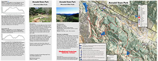
About the Bay Area Mountain Biking Map Set: Set of 16 two-sided maps include Mount Tamalpais and Marin Headlands near Mill Valley, Bolinas Ridge in Western Marin, Camp Tamaracho and Pine Mountain, China Camp State Park, and Annadel in the North Bay. East Bay maps include Briones, Tilden, Wildcat, Chabot and Redwood Open Space Parks, Mount DiabloState Park, and 2 maps covering Henry Coe State Park. Santa Cruz Mountains maps include El Corte de Madera (Skeggs) and other Mid-Peninsula Open Space areas such as Russian Ridge and Saratoga Gap. Close to Santa Cruz are Wilder Ranch State Park, and Soquel Demonstration Forest. |
||
Benefits vs Similar Products:
|
||
Read What Customers are Saying about BikeMapDude Maps. |
||
Purchase from BikeMapDude-It's Fast, Secure and Guaranteed
|

